American Pioneer
& Cemetery Research
Project
Internet Publication
Version 071311
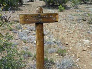
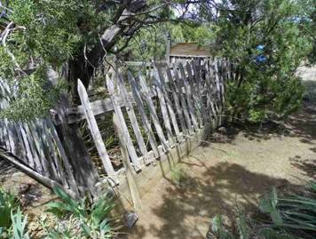
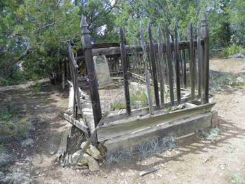
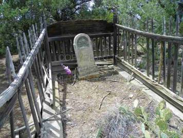
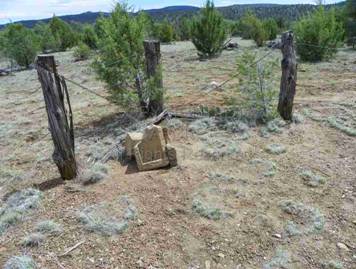
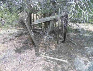
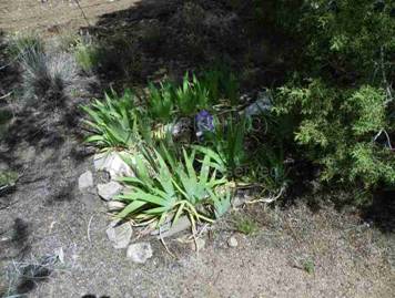
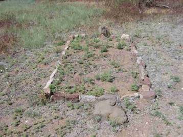
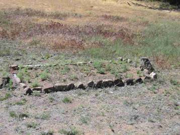
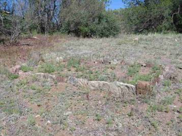
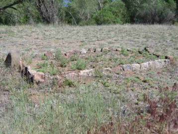
WALNUT CREEK CEMETERY
PRIVATE PROPERTY – DO NOT TRESSPASS
A.K.A.
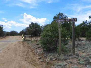
Camp Toll Gate – Camp Hualapai – Juniper Cemetery
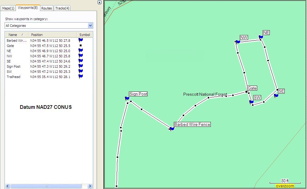
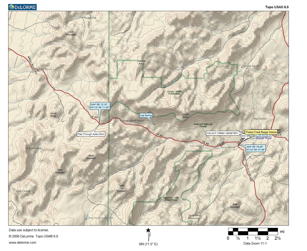
N34 55 47.5, W112 50 25.5
(NAD27)
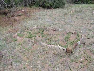
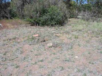
SECOND LOCATION UNNAMED CEMETERY - Six Graves
N34 55 16.25, W112 50 47.49 (NAD83)
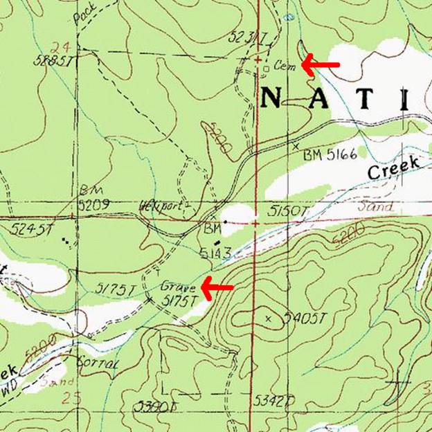
Arrows indicate the Walnut Creek
Cemetery (Upper), Unnamed Graves (Six) (Lower)
WALNUT CREEK
CEMETERY (2011)
PRIVATE PROPERTY – DO
NOT TRESSPASS
Map
of the Walnut Creek Cemetery courtesy Jim & Barbara Marcel
Arguably the name of this cemetery has
changed with the tide of military and civilian activity in the immediate area.
Today with little attention being paid to either of these cemeteries only
locals and cemetery preservation historians take an interest in maintaining
either of these sites. History indicates Indians then military camps were the
first to occupy this area followed by civilians. It has been questioned if the
Walnut Creek Cemetery was a military cemetery? Civilian headstones place their
burials spanning between 1881 and 1897.
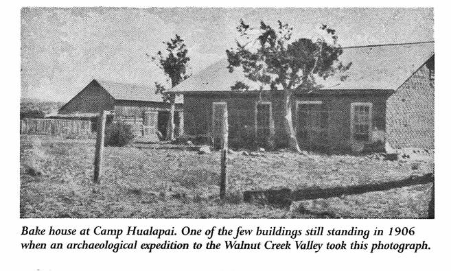
Camp Hualapai was an U.S. Army
installation between 1869-1873; Camp Toll Gate
preceded the name change by one year. The Army camp numbered approximately 250
soldiers during peak occupation. In the five years of Army Camps, were any of
these unmarked graves soldiers? Research at this point has not been able to
determine any Soldiers or Indian graves.
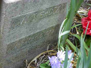
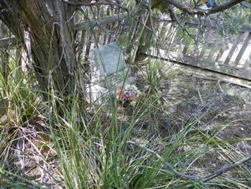
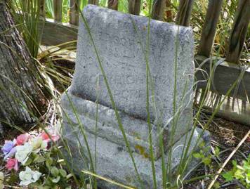
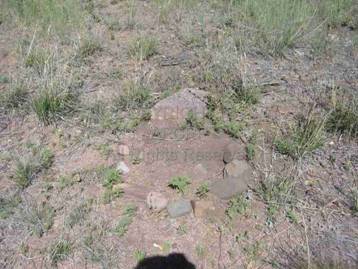
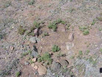
Three names have been documented with
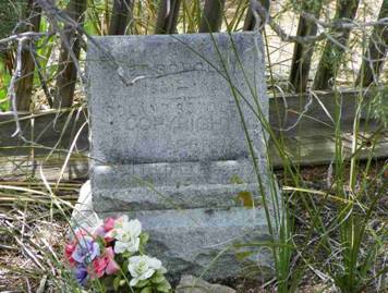
headstones, W.T. Shook, Ed S. Scholey, Roland Scholey, and Marilla Jane Rogers.
Based on placement of rocks outlining unmarked graves there is potentially four
or five more graves without headstones. Possible burials in unmarked graves are
Ida Goodman, Robert Jefferson Young. One person has been documented that their
ashes were scattered at this cemetery.
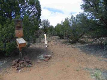
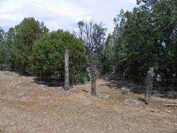
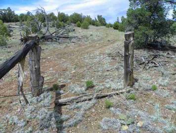
A fence currently encloses this
cemetery which is on private property. If the perimeter of this fence was the
original fence enclosure, based on the .26 acres there is room for up to 211
interments in this cemetery less the nine visible graves there is still room of
202 interments. Are there unmarked graves yet to be indentified whether
Military or civilian? It is very likely based on APCRP research experience with
other Historic Pioneer Cemeteries in Arizona.
A complete research of historic Death
Certificates has been finalized with no additional names listed as buried here.
It is also possible this was the plotted size of the cemetery and here are no
other graves here, we will try to determine the historical facts.
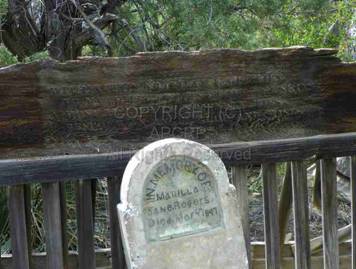
|
Edward
S. (Ed) SCHOLEY b.
1851, Il. |
Roland
SCHOLEY b.
1878, A.T. |
Urban
Legend has it; they are buried in the same grave.
Others
state: “Ed and infant son Roland are buried at Walnut Creek cemetery”. TBD.
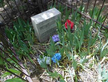
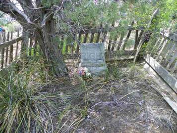
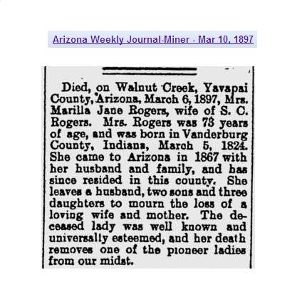
Marilla Jane Rogers
Born: Vanderberg County, Indiana 05 Mar 1824 Died: Walnut Creek,
Yavapai, Arizona Territory 06 Mar 1897
Buried: Walnut Creek cemetery. Plot: Marker: yes
Spouse: S. C. Rogers
OBIT-- Weekly Journal Miner 10 Mar 1897 page 2:
To Arizona Territory in 1867 with her husband.
|
|
|
|
|
|
|
|
|
|
|
|
|
|
|
|
|
|
|
|
|
|
|
|
|
|
|
|
|
|
|
|
All
photographs above courtesy Jim and Barbara Marcel.
----------------------------------------------------------------------------------------------------------------------------------------------------------------------------------------------------------------------------------
AZTEC PASS
The road west of Camp Walapai/Camp
Tollgate/Camp Hualapai/Juniper/Walnut Creek, that has been referred to by
historians as AZTEC PASS was so named by Lieutenant Whipple exploring a railroad
route in 1863, “so called on account of
extensive ruins of houses and fortification that lined the banks. Wide Indian
trails and ruins of extensive fortifications constructed centuries since upon
the height to defend it show that not only present tribes but ancient races had
deemed Aztec Pass of great importance.” This is approximately 12 miles along
the road between O RO Ranch and the Camps/Walnut Creek. This mountain range was
originally named the Aztec Mountains, later changed to Juniper Mountains. This
pass was part of the 165 mile Hardyville Toll Road from Fort Mohave (near
Hardyville today Bull Head City) to Fort Whipple (near Prescott).
The toll was 1 1/2 cents per mile for a
wagon and two horses which equaled $2.48 if you traveled the total distance.
That is equal to $250.00 in today’s money to travel 165 miles plus it could
take up to 20 to 30 hours depending on road conditions and other things that
could slow down travel time. 2 or 3 hard days to travel that
distance.
In 1864 the toll was;
Each wagon and two horses 1 ½
cents per mile
Each additional animal ¾
cent per mile
One horse and vehicle ¾
cents per mile
Pack animal ½
cents per mile
Horned cattle, horses and mules and
others in droves ½ cent per mile
Sheep, goats or hogs ½
cent per mile
As mapped currently the actual geographic
Aztec Pass is eight miles east of current day Walnut Creek, is located at
N34º58'30", W112º38'03" on Topographical maps and Google Earth. There
is evidence the “Road To Prescott” traveled 3 ¼ miles
east of Walnut Creek, crossed ESE across the creek and headed toward Prescott.
The pass for which local residents have
referred based on Whipple’s identification, gains approximately 1,000’ at the
point of N34 56 12.10, W112 58 11.45 between the O RO Ranch and Walnut Creek.
-------------------------------------------------------------------------------------------------------------------------------------------------------------------------------------------------------------------------------------------------------------------------------
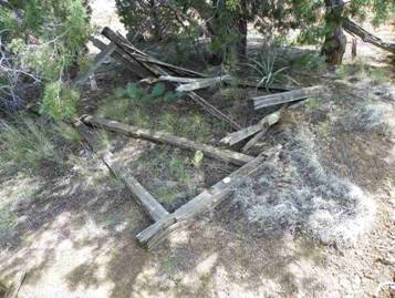
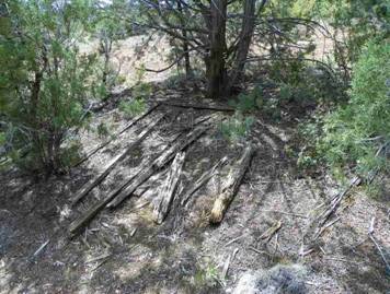
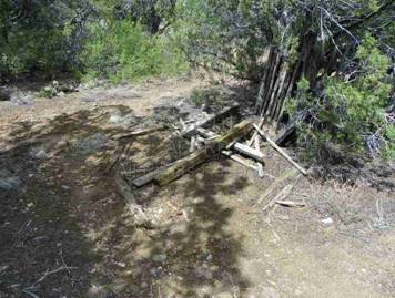
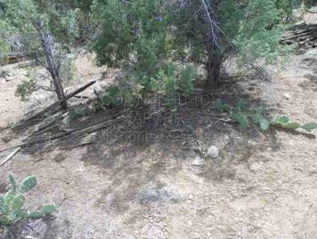
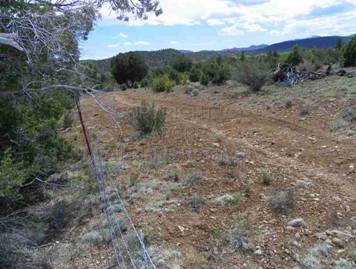
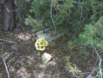
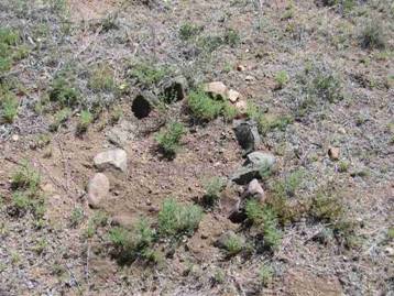
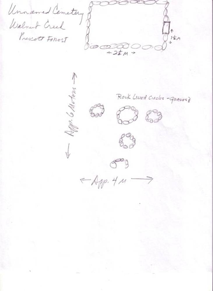
SECOND LOCATION UNNAMED CEMETERY - Six Graves (2011)
N34 55 16.25, W112 50 47.49
(NAD83)
Of
the six graves in this separate location to the southwest of the Walnut Creek
Cemetery, there is reason to believe there are five children’s graves and one
adult grave. Research continues to try and identify the individuals interred in
this second location. We will try to determine if this is a family traveling
through or ranch grave site.
|
|
|
|
|
|
|
|
|
|
|
|
All
research and Photographs above courtesy Todd Zuercher
Courtesy
Shelley Rasmussen and Bonnie Helten
1
Meter equals 3.28 Feet
Miscellaneous Information:
January 28, 1906
TWO HUMAN SKELETONS FOUND AT WALNUT CREEK – Word reached this city last night
that the Ainsworth boys discovered two human skeletons buried about 100 yards
distant from their residence in the Walnut Creek section. The grave in which
the discovery was made was only about 18 inches in depth, and their attention
was first attracted to the gruesome discovery by squirrels which had burrowed
into it and carried a small piece of the bones to the surface.
Courtesy
Todd Zuercher
Courtesy
Bonnie Helten
Map
courtesy Bonnie Helten
American Pioneer
& Cemetery Research
Project
Internet Publication
Version 071311
WebMaster:
Neal Du Shane
Copyright © 2011 Neal Du Shane
All rights reserved. Information contained within this
website may be used
for personal family history purposes, but not for financial profit or gain.
All contents of this website are willed to the American Pioneer & Cemetery
Research Project (APCRP).