HOME | BOOSTER | CEMETERIES | EDUCATION
| GHOST TOWNS
| HEADSTONE
MINOTTO |PICTURES | ROADS | JACK SWILLING | TEN DAY TRAMPS
Presentation
Version 071707
PACKER
To reach Packer today start on I-17, exiting at
At this point, you are at a three way intersection, the road
to the left takes you up and over the mountain to
The road straight west takes you to the Acquisition Mine and Swilling Gulch, At the Acquisition Mine most people turn around and come back the same road. Swilling Gulch to Curly’s Place is a foot trail. Suggest not taking the extremely technical road straight ahead, rather turn to the right and follow this road until you come to a road on the left (approximately ¼ mile). This road will connect with the technical road in approximately ½ mile.
The road to Packer is the road to the right (north). There
are several roads leading off this road so stay on the main road for about 6
miles and you will come to the ghost town of Packer,
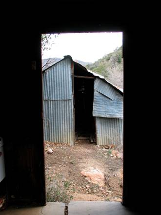
Structures – Packer, AZ 2007 Photograph by: Neal Du
Shane
"About 20 years ago
I spoke with Slim at the
When visiting Packer in 2007, it is a peaceful outpost. Two tin and wood structures remain, with a windmill, cement watering trough and stone well house building. As described above its easy to see this was a repacking junction. Although it is surprising Packer didn’t have more structures and population.
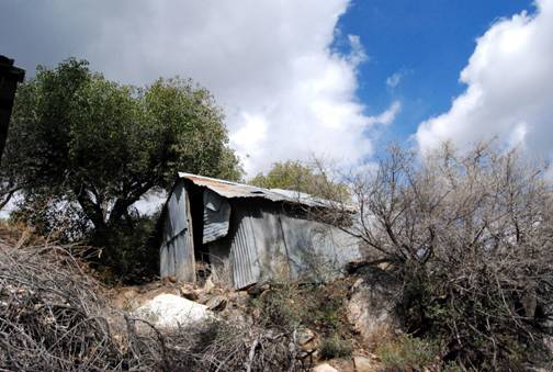
Packer 2007, Photograph by: Neal Du Shane
Many mines operated in this general area and supplies and
equipment could have been reloaded for distribution to these mines at Packer.
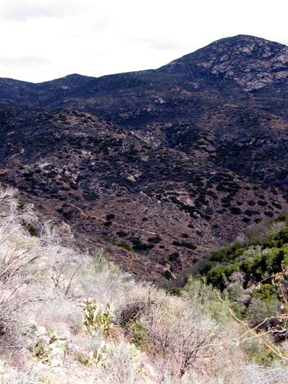
Several roads converge near Packer and would have been on the main route from
The existing road from I-17 to Crown King was a railroad
right of way from Cleator to Crown King and there was no regular road along
this route in those days. Currently the road traverses the old railroad bed.
Routes of travel were totally different during the hay day of this region of
the
Road to Crown King from Packer, Photograph by Neal Du
Shane 2007
Is it possible when Doc. Holiday and Big Nose Kate stayed in
Tip Top, they passed through Packer? It’s likely, as this was the convergence
on the trip to depart to points south from
Most of the roads leading to and or from the
Packer, AZ 2007. Photography by: Neal Du Shane
Many skeletons of derelict mines dot the country side along this road, reminding us of the prosperity and or hard times of years past.
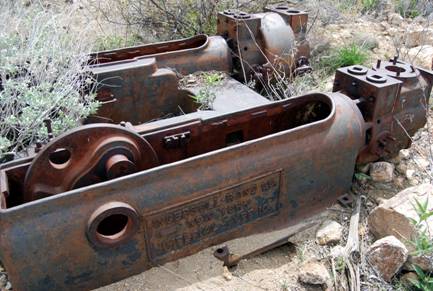
Mining equipment on way to Packer. Photograph by: Neal
Du Shane
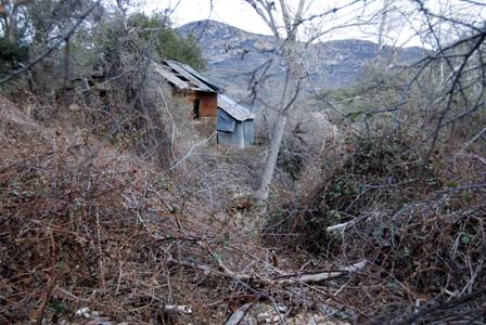
Speculation; Packer may have been a ranch line camp in later years but now is totally abandoned.
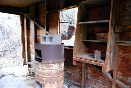
Packer interior of house 2007 – Photograph by: Neal Du
Shane
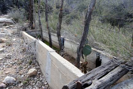
Water trough at Packer 2007. Photograph by Neal Du
Shane
Acknowledgement: Mark Quigley. Bob Cothern, Tom Kenson,
Bruce Colbert, Jack Horton of the
Neal Du Shane 5/8/07
APCRP Internet Edition
Published by: Neal Du Shane
Version 071707
WebMaster: Neal Du Shane
Copyright ©2003-2007 Neal Du Shane
All rights reserved. Information contained within this website may be
used
for personal family history purposes, but not for financial profit of any
kind.
All contents of this website are willed to the American Pioneer &
Cemetery Research Project (APCRP).
HOME | BOOSTER | CEMETERIES | EDUCATION
| GHOST TOWNS
| HEADSTONE
MINOTTO |PICTURES | ROADS | JACK SWILLING | TEN DAY TRAMPS