HOME | BOOSTER | CEMETERIES | EDUCATION | GHOST TOWNS | HEADSTONE
MINOTTO | PICTURES | ROADS | JACK SWILLING | TEN DAY TRAMPS
American Pioneer & Cemetery Research Project
Internet
Presentation
Version
123011
Lehman Mill
By
Todd Zuercher
I
remarked to several people recently that our quest of finding Lehman's Mill in
the Bradshaw’s had taken on some similarities to Coronado's search for the
Seven Cities of Cibola. Well, today I am proud to say we found it!
This little dot on the topo map has intrigued me for years. A few years
ago Paul and I found something that we thought was the mill, but turned out to
be another leftover from bygone days in the Bradshaw’s. Last month, Neal
and I and a few other APCRP'ers tried to come in from the south near Copperopolis
and Ike Bradshaw's Grave. Foiled again by Google Earth . . . . Two
weeks ago, Kevin Hart from APCRP got VERY close but missed the last turn down
into the canyon where the mill is located.
Today
our merry band of adventurers was 4 vehicles strong: Kevin in his Jeep CJ,
Robin and I in Broncitis, Neal on his quad and Gary on his quad. We left
Lake Pleasant at 8 sharp and headed north along the
Cow Creek Road.
Between
the Crown King Trail turnoff and the turnoff for the road to Tussock Spring, we
stopped, at my request, to view the hilltop where a gorgeous home was very
nearly completed in the 1970s by a Dr. Davidson and his wife Betty from
Phoenix. Boasting 13 fireplaces, inlaid glass and rock work and beautiful
woodwork, it was nearly finished and apparently a sight to behold when the
doctor suddenly died. Betty never lived there and for many years the home
was a favorite visiting spot for n'er-do-wells, who managed to completely trash
it, as is the custom with most nice remote treasures in AZ. It is now
thankfully blocked from public access, except for some helicopter pilots who
land their craft near the remains. We visited with "Tato", one
of the caretakers of the ranch buildings at the bottom of the hill, today and
heard about the home and their efforts to keep people from visiting it. Hopefully
someday we'll get a chance to visit it. Neal, in typical fine form, pulled
a lot of information out of this interesting woman in a very short time.
|
Dr. Davidson abandoned
home. Photo courtesy Gary Grant |
Onward
and upward, after stopping to retrieve Gary's wallet in the middle of the
trail, we soon found ourselves at Tussock Spring where interesting history took
place back in 1922.
http://www.apcrp.org/Tussock%20Spring/1_Tussock_Spring_MASTER_020110.htm
Neal
Du Shane writes,
Betty
Davidson still owns the ranch and lives in Phoenix. Mrs. Elston (Tato) who now
lives with her husband Harold (Pee Wee) at the ranch as caretakers had a
version of the account at Tussock Springs that was different than what research
had uncovered. Local Urban Legend has it that Mr. McClure arrived home early
from an extended absence to find Mrs. McClure and Mr. Bourne together. It so
enraged Mr. McClure he shot and killed Mr. Bourne and during Mr. McClure’s fit
of anger, he killed the Bourne/McClure baby with an ax. This act so enraged
Mrs. McClure she shot and killed Mr. McClure. While this is an interesting and
possible twist to the incident, it doesn’t follow the testimony of individuals
in Wagner prior to the shootings as to the placement of the individuals. Mrs.
McClure’s account of the incident leaves one to ponder what really happened
that day. It is likely we may never know the actual facts of the double
homicide.
Todd
continues,
This
was Robin's first visit to the area so we gave her the nickel tour and checked
to make sure the stones we placed there in late 2009 were still there. They
were and are undisturbed.
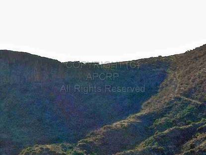
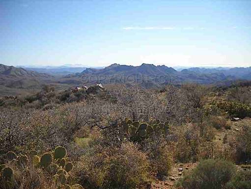
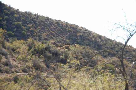
|
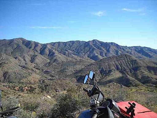
Breathtaking views abound on the way to Lehman
Mill Photo courtesy Gary Grant |
|
From
here we motored northwest for several miles before turning south again, high on
a ridge to the west of the Tussock Spring area. After dropping off the
ridgeline, we soon came to the spot where Neal and Kevin said we needed to drop
into the canyon near the alleged site of the mill. The road/trail we were
on showed absolutely zero signs of traffic (so rare in the Bradshaw’s these days)
- steep, rutted, and faint. Perfect!
The
trail down into the canyon and in the canyon itself is narrow, off-camber, rocky,
and steep at points. A CJ and an early Bronco can barely squeeze through -
definitely not full-size territory. Robin and I kept busy batting away
bushes from intruding into our windows. At one point, she asked, "Is
this why you don't paint your truck?" I laughed and nodded. After
what was probably a little more than a mile, we came to an old corral and a
windmill (not shot up in the fine AZ tradition). We knew we were
close! Neal had been scouting ahead and led us to a small clearing where
we all parked and started exploring.
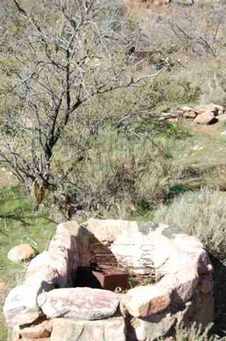
|
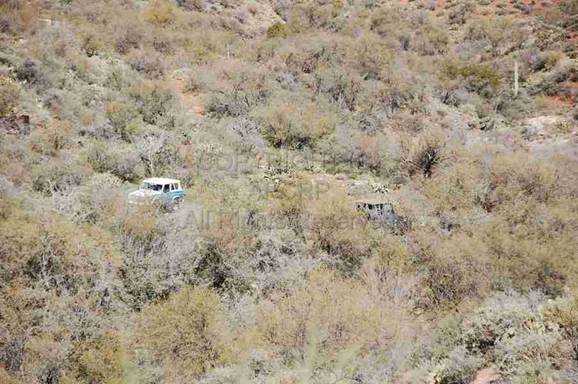
Parking
abounds at Lehman Mill. Photo Neal Du Shane |
Lehman Mill Boiler,
west side of creek. Photo Neal Du Shane |
|
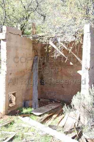
Cement
structure on west side. Photo Neal Du Shane |
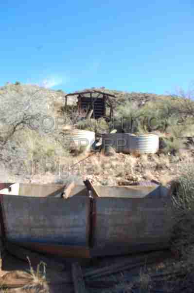
Water
holding structure. Photo Neal Du Shane |
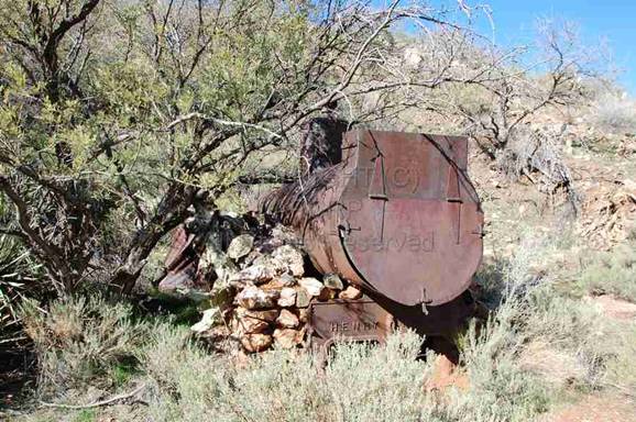
This
area was across the creek to the west of the Lehman Mill site and had an old
boiler and miscellaneous mining equipment scattered about. Logically it would
indicate the Stamp Mill would be on this side as there is water from a well to
supply the steam engine.
|
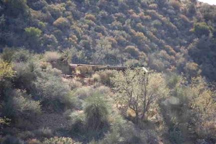
Lehman Mill,
Photo Neal Du
Shane |
Lehman Mill Boiler. Photo Neal
Du Shane |
Machinery.
Photo Neal Du Shane |
|
Lehman Mill and structures.
Photo Neal Du Shane |
Lehman Mill.
Photo Todd
Zuercher |
Holding tanks.
Photo Neal Du
Shane |
|
Lehman Mill operation.
Photo
Neal Du Shane |
Lehman Mill Close-up.
Photo
Neal Du Shane |
Ore holding.
Photo Neal Du
Shane |
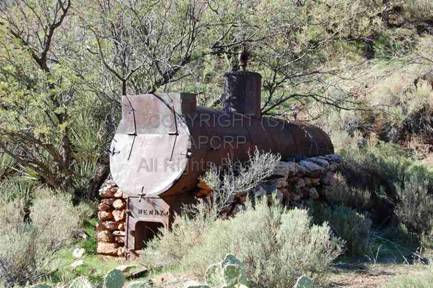
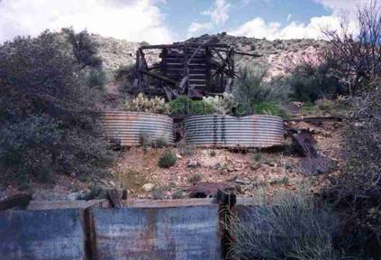
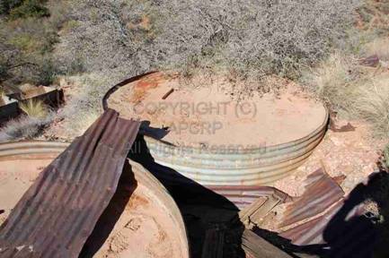
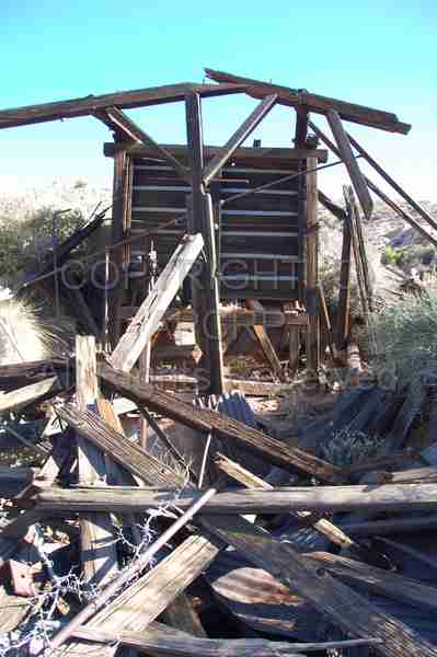
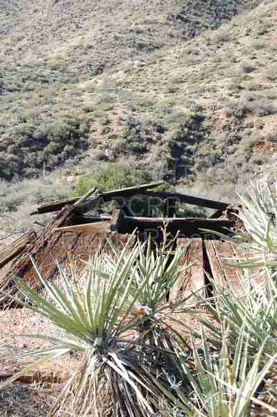
The
head-frame/ore chute in the pictures is remarkably intact. We found several
circular concrete cisterns/tanks nearby where chemicals or water were probably
used in the processing of the ore. We also found some evidence also of
buildings and dwellings nearby, along with the boiler seen in one
picture.
Where
the ore came from or what it was exactly is a bit of a mystery as we know of no
mines/shafts/prospects in the immediate area and there is no evidence of a road
that ore would've been brought in on. Copperopolis is about a mile to the
south but the old road connecting the two sites is in poor repair and
impassable.
A
neat place - not often visited.
I'm
glad to have finally found it!
Thanks
Kevin and Neal for organizing the trip.
American Pioneer & Cemetery Research Project
Internet
Presentation
Version
123011
WebMaster:
Neal Du Shane
Copyright © 2012 Neal Du
Shane
All rights reserved.
Information contained within this website may be used
for personal family
history purposes, but not for financial profit or gain.
All contents of this
website are willed to the American Pioneer & Cemetery Research Project (APCRP).
HOME | BOOSTER | CEMETERIES | EDUCATION | GHOST TOWNS | HEADSTONE
MINOTTO | PICTURES | ROADS | JACK SWILLING | TEN DAY TRAMPS