HOME | BOOSTER | CEMETERIES | EDUCATION
| GHOST TOWNS
| HEADSTONE
MINOTTO
| PICTURES
| ROADS
| JACK SWILLING
| TEN DAY TRAMPS
Internet Presentation
Version 112008

AND CEMETERIES
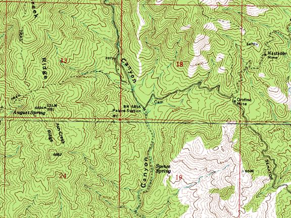
Palace Station is located approximately 17 miles South of
Prescott, AZ on the historic
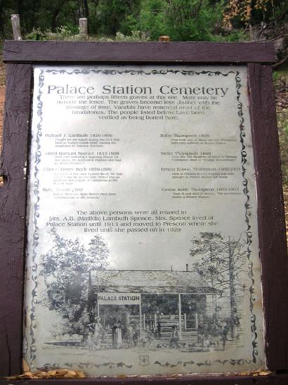
Photo courtesy: Todd Zuercher
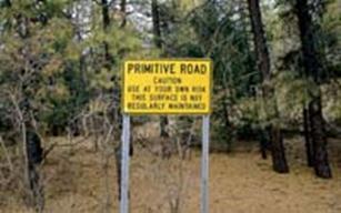
PRIMATIVE ROAD - Caution enter at your own risk!
Palace Station was a historic stage station and stage stop, built in 1874 as a two room structure with a loft. The structure was expanded in 1878 to its present size. The U.S. Forest Service has owned it since 1963.
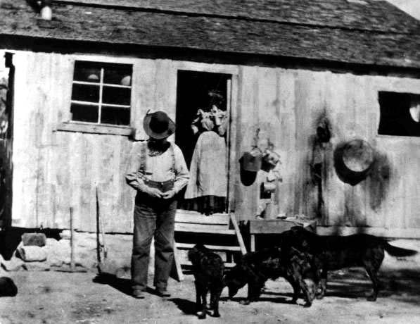
Original Palace Station, 2 rooms and a loft. C. 1875
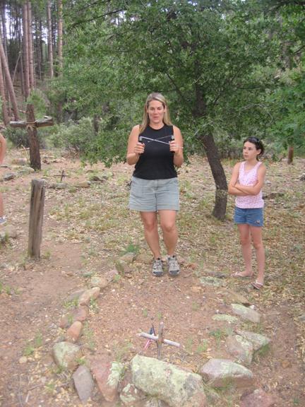
Molly Littrell
identifying an adult male grave at
Palace Station is one of many gold mining communities that
sprung up to serve the needs of residents in the
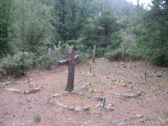
Photo courtesy: Todd Zuercher 7/03/08
Palace Station resides peacefully along the historic
In 1873 Alfred B. Spence, his wife Matilda and her father,
R.J. Lambuth, came to
In 1877 the
Stage passengers were not offered overnight accommodations,
however many travelers did partake in the very rustic overnight accommodations.
For Stage passengers, Palace Station was only two hours from
Historic Palace
Station,
It is probable that Doc. Holiday and his girl friend at the
time, “Big Nose” Kate traveled through Palace Station on their way from
Palace Station was known to have had a saloon. For the miners and their families that worked in the area, Palace Station provided a social gathering point also.
Alfred Spence died in 1908 and is buried in the
Palace Station is now used by U.S. Forest Service, the structure is closed for the public however the exterior, grounds and cemetery reveal a historic authentic atmosphere of the station and mining district.
Sadly many historic buildings in
AREA MINES
Arizona Central Mining Company claims: A group
of 14 claims located in
Consolidated Bodie Mine: Workings include 2
shafts at 100 & 180 feet deep (1881), plus a 480 foot long tunnel.
Crook Mine: Workings include 670 feet of shafts and 850 feet of tunnels; a 100 foot deep shaft (1934) & a long tunnel 160 feet below the outcrop. Worked to 220 feet. Early workings were open cuts to about 40 feet deep over 4,700 feet along the vein. Total output was some $250,000 of metal (period values).
Tom and Dick Mine: Workings include a 175 foot deep shaft plus 500 feet of drifts on 2 levels. A 2-stamp mill was erected.
Mastadon Mine: approximately ¾ mile east and slightly north of Palace Station.
Orofino Mine:
approximately ½ mile east on the
Note: Todd Zuercher told Molly Littrell’s
father, Jack Orr (the one who identified the names of the children in the
The
APCRP currently has the names of eight of the presumed fifteen graves and will try to identify each grave and mark them with the name of the interred. Rumor has indicated there may be more graves outside the current enclosure; we will try to identify and mark these graves also.
Internet Presentation
Version 112008
WebMaster: Neal Du Shane
Copyright ©2003-2008 Neal Du Shane
All rights reserved. Information contained within this website may be
used
for personal family history purposes, but not for financial profit of any
kind.
All contents of this website are willed to the American Pioneer &
Cemetery Research Project (APCRP)
. HOME | BOOSTER | CEMETERIES | EDUCATION
| GHOST TOWNS
| HEADSTONE
MINOTTO
| PICTURES
| ROADS
| JACK SWILLING
| TEN DAY TRAMPS